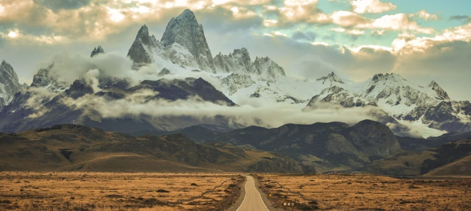
Argentines fondly refer to RN-40, or Ruta 40, the country’s longest road, as La Cuarenta (The Forty). Stretching from Cabo Vírgenes, the southernmost point of the Argentine mainland, to northernmost Ciénaga, on the Bolivian border, it’s more than just a highway. Like Route 66 in the US, the road has its own ethos – inspiring songs, books and arguments – and is as central to a visit to Argentina as a football match or a milonga. La Cuarenta runs a staggering 5224km – roughly the distance from Amsterdam to Kabul. Partly to make it more attractive for tourists, the road’s route has been changed over the years. Ruta 40 now starts at the ocean at Cabo Vírgenes and winds north through eleven provinces, past twenty national parks and across 24 major rivers, before reaching the altiplano. There it breaks a record: the dizzying Abra de Acay, at 5061m, is the highest point on a national road anywhere in the world. Although sections are relatively busy, notably around Bariloche and between Mendoza and San Juan, most of La Cuarenta runs through Argentina’s magnificent open spaces, seldom more than 100km from the majestic peaks of the Andes. Many visitors are drawn by the road’s rugged mystique – a result of its inaccessibility and frequently poor condition – while others are put off for the same reason. The Argentine government has pledged to pave the entire road but hasn’t completed the task yet. Between a navy lighthouse at Cabo Vírgenes, La Cuarenta’s starting point, and Chos Malal, in Neuquén Province, the road zigzags across the Patagonian steppe, a barren, windswept expanse thickly blanketed with snow during the winter.
North of Neuquén Province, Ruta 40 enters El Cuyo, Argentina’s western midlands. It meanders through La Payunia, in Mendoza Province, a land of rosy lava and ebony gorges, deep karstic caves and flamingo-flecked lagoons, before passing near Laguna Diamante, an all-but-inaccessible lagoon from where you can admire the silhouette of Laguna Diamante. Further north, in La Rioja Province, the road skirts sunny valleys and hugs the Cuesta de Miranda, a serpentine corniche winding through polychrome mountains.

La Cuarenta’s last – and highest – stretch cuts through the historic northwest. Rippling hills, herds of goats and crumbling adobe houses are typical sights here. For a top-notch poncho, stop off at Belén, in Catamarca – traditional methods of weaving have been maintained in this highland village since pre-Hispanic times. You’ll also want to stop in Cachi, for a photo of the surrounding snow-topped sierras and valleys. Just before Ruta 40 reaches Bolivia, it is spanned by the mighty La Polvorilla viaduct, a fabulous feat of engineering. The road was constructed in 1935. To do the full trip requires a combination of vehicles, because much of the road is unpaved. Some stretches require just a regular car, others need a 4x4. Special care is required, though, especially further south where strong crosswinds and poorly maintained gravel (ripio) roads make it extremely easy to flip over. With its notoriously poor surfaces – just dirt and gravel in sections – hairpin bends, and endless straight sections buffeted by violent gusts across the deserted steppe, it is considered one of the world’s most epic drives. There is no cell-phone coverage outside of towns, so drivers must be self-sufficient. Travel with necessary repair equipment. Gas stations are few, so fill up at every chance, and bring generous supplies of food and water.
Source:
https://www.roughguides.com/argentina/patagonia/legendary-ruta-40/
edited by olivia